Thousands of Miles of Waterways
I have heard many figures quoted for the number of miles of navigable waterways in the UK: It is certainly several thousand. How do you find your way around such an extensive network?
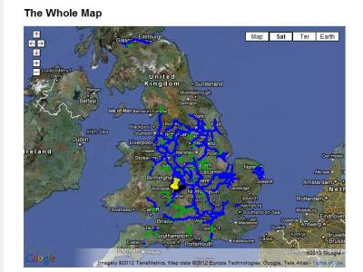
Well there is a route planner Canalplan which I love. It's great for planning routes and will give you an itinerary, plot your route on Google maps and show you a photographic tour.
Mike Kelly's EureauWeb Water-way application is a great location aware information system that is really useful to have on board. All the information and route-planning of a Nicholson's Guide plus more, in electronic form.
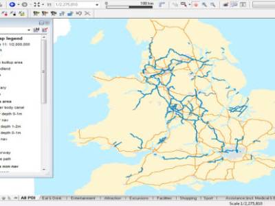
Lately I have found this great map of the inland waterways at the UKWRS site.
So now you know how much of the waterways there is to explore and you have the means to find your way around. Jump into the site and look at all the narrowboats for sale that we have in Hertfordshire and London as well as the Dutch Barges and Wide-beams.
Image Gallery